Hikers

Water and facilities for hikers and campers

Where the next reliable water is, and what facilities are on your route.

  • Drinking water
  • Springs and raw water
  • Toilets
  • Showers
  • Laundry
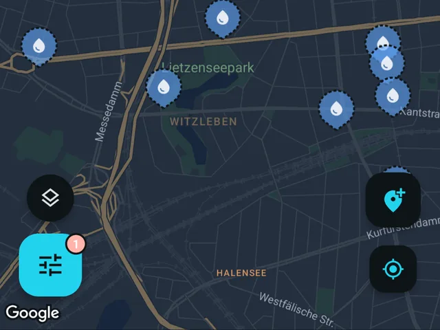
The Fontavio map with the drinking water filter on, showing water points across a city.

Fontavio shows where water is along a hike, so you can see what is ahead and plan what to carry.

Fontavio maps drinking water, natural springs where their potability is documented, and the toilets, showers and laundry at the places you stop. Seasonal closures are shown where known.

With Pro you can download the area you pick, base map included, so the map works without signal.

One caution about natural water sources: a spring is only shown as drinking water when the source data says it is safe. When potability is contradicted or unknown, it is mapped as raw water instead. Treat unverified water accordingly.

The things that matter

01 PRO

Offline maps

Pick an area on the map and download it. The base map, the places and their details all come with it, opening hours and reviews included, so everything keeps working with no signal at all. Photos are the one thing left out, to keep the download small. Built for valleys, borders and prepaid data.

02

Compass and navigation

You can see what is closest or pick a place on the map, then follow the compass or use navigation. A home-screen widget and app shortcut open straight into the closest one, so it is one tap from a locked phone.

03

Open now

Opening hours and seasonal dates are shown where they are known, checked live against your phone’s clock. A fountain that is off during winter says so.

04

Confirmed by the people using it

Every place carries a badge for whether a person has confirmed it works. One tap confirms it, one tap reports a problem, and repeatedly wrong edits limit an account.

Look up a city before you go

Search any city and the map jumps there. These pages show samples of the available data and statistics for cities.

Hikers: common questions

Does it show natural springs?
Springs are included where the source data says the water is drinkable. One with no potability information is not imported as drinking water; it is mapped as raw water instead. Contributors add springs too, and the same rule applies to those. Make your own decision about water quality from what you see on site.
Will the map work with no signal on the trail?
Anywhere you have already opened stays cached for a few hours. For a region you have not looked at yet, Pro downloads the map for an area you pick before you leave.
How does it handle taps that are turned off in winter?
Seasonal places carry their season where it is known, and the app shows them closed outside of that season. That information comes from open data and from contributors, so it is better in some regions than others.
How far is the next water from here?
Closest shows the nearest one with the distance and a walking estimate. It reads from the map already on the phone, so it still answers in flight mode. From there, follow the compass or use navigation.
Is a spring shown as drinkable actually tested?
Not by us. It is shown as drinking water because the source data or a contributor said it was, and that is not a test result. Nothing on this map is sampled or certified, so treat it as information.

More in the full FAQ.

Other ways people use it

Get it before the next long walk.

Free on iOS and Android. No account needed to browse.